Shadow and cloud can affect pasture readings from SPACE™ because the grass is effectively hidden when the satellite takes an image of a farm – but we’ve found a way to help the system get around this.
The new features identify the areas of the farm affected by shadow and cloud as part of the automated image analysis, and exclude the areas from the calculation for the paddock cover.
As SPACE™ takes multiple sample points across each paddock and averages the results, pasture covered by shadow or cloud gets under-read and can skew the average reading for the whole paddock. Removing these areas from the calculation will result in more accurate cover estimates for paddocks that are affected by shadow or cloud.
A new, additional map in SPACE™ reports show the areas affected by shadow and cloud. This map can be used alongside the pasture cover map to interpret why each of the paddock covers are what they are.
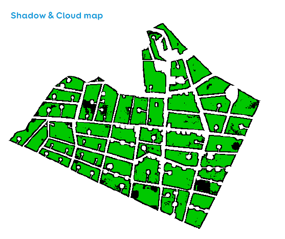
Green areas: no shadow/cloud interference – included in pasture readings.
Black areas: suspected shadow – excluded from calculation.
Grey areas: suspected cloud – excluded from calculation.
As part of our work to fine-tune SPACE™, we are continuing to make upgrades to the system to improve accuracy and reduce variation. Continuously improving the service is our priority and we’re excited to share these new features.