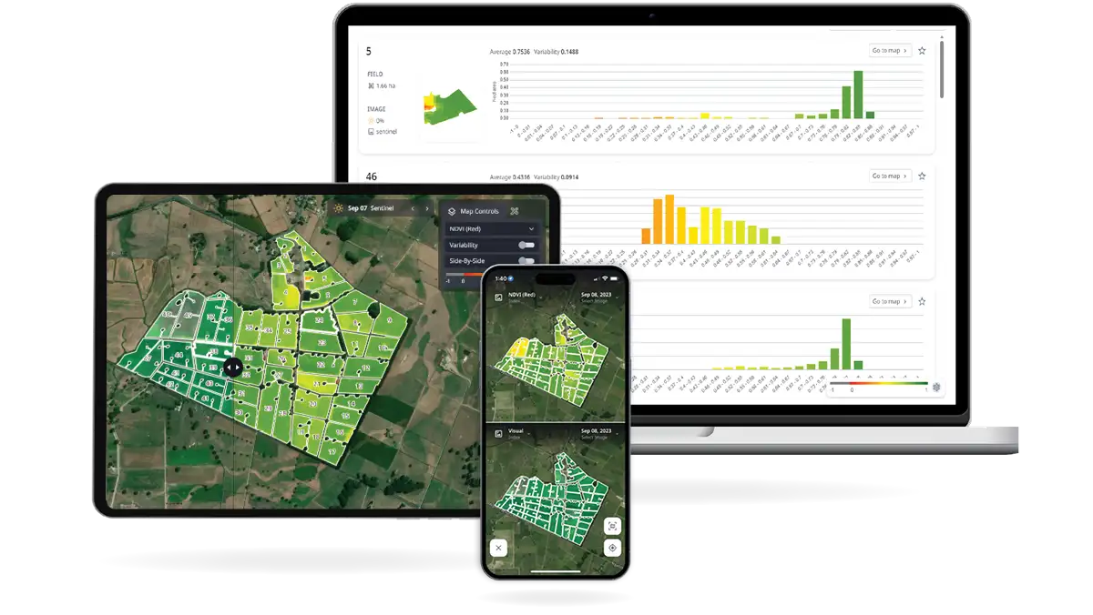
Not only are high-resolution satellite images* of your farm available right at your fingertips, you also have access to analysis for easier monitoring and evaluation of pasture cover and vegetation health across your farm.
While the full suite of Cropwise Imagery tools can be accessed via the web, the mobile application (Apple iOS and Android devices) provides a simple feature set intended to bring the power of satellite imagery to your mobile device. The Cropwise Imagery app helps you to monitor changes at the paddock level while on-the-go, and send important updates via text, email or your favourite messaging app.
The key components of Cropwise Imagery mobile application include:
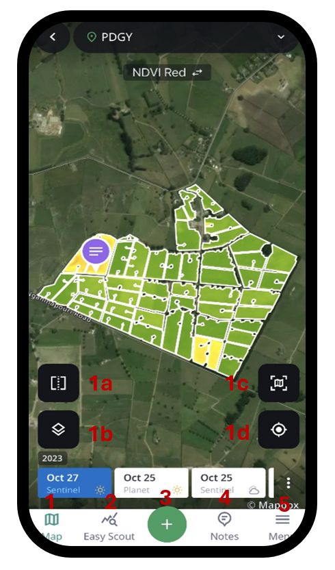
Map to analyse satellite imagery of your farm. Selected images can be displayed according to the metric of interest (e.g., NDVI or visual) and colour palette. Functions within Map include:
1a. Side by side compares two images of your farm using different dates of image capture or different evaluation indices.
1b. Map options allows you to see the paddock names and notes created for your farm in Map, as well as to download an image for offline use.
1c. Centres map to the entire selected property.
1d. Centres map to device GPS location.
Easy Scout shows the paddocks that are experiencing the greatest change in average NDVI value over a period. This allows you to prioritise and save time when determining which paddocks to investigate first on the farm walk.
Quick actions to create a note or a paddock.
Notes to mark areas of interest within a paddock for future reference or to share these observations with members of your farm team or trusted advisors.
Menu provides quick access to features within the app, which are listed for ease of use. On top of those features found within the landing page, these include:
- Prescriptions to review and update paddock prescriptions recorded within Cropwise Imagery web application, such as fertiliser, weed spraying or seeding use for specific management zones.
- Dashboard for quick analysis of recent available satellite images and localised weather for a selected farm.
* You will only receive a SPACE™ report when a clear image is available, which can be up to 72 hours after image capture.
An image may not be available every day due to variations in satellite pathing.
Modelled estimates are not included in Cropwise Imagery, which presents satellite - based information only. This data does not flow through to MINDA® Land & Feed.